

Online Reporting
The Azusa Police Department offers online reporting for certain non-emergency reports such as theft, lost property and vandalism. Please confirm the following information before making an online report.
- This is not an emergency.
- This incident occurred within the Azusa City limits.
- There is no evidence to be collected.
- There are no known suspects.
- You are 18 years of age or older.
- You have a valid e-mail address.
If all of the above information applies to your case, you can file an online report. If any of the above circumstances do not apply, please call us at (626)812-3200 for non-emergencies and call 911 for an emergency.
The Azusa PD Blog
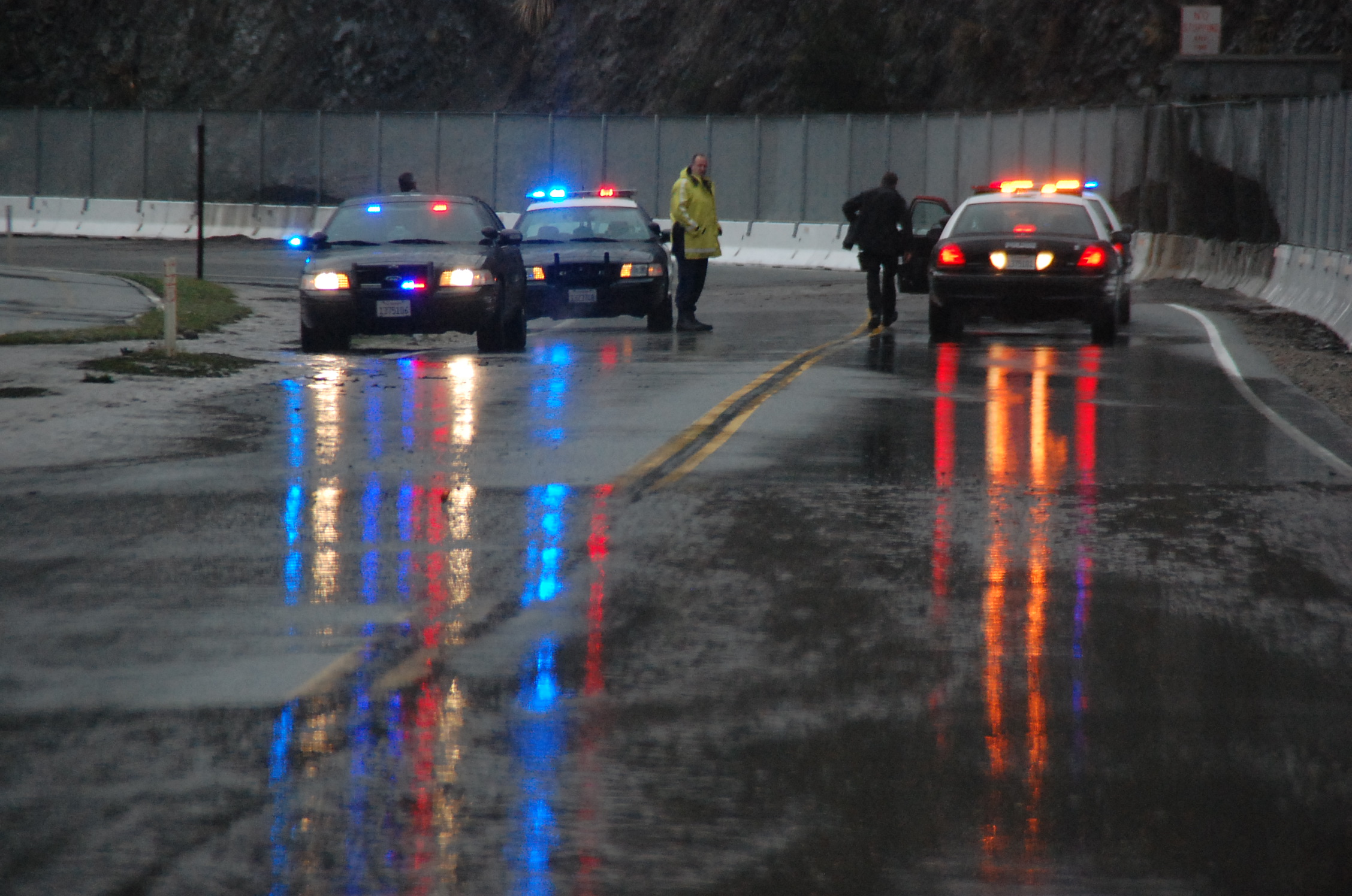
Approaching Storm For December 11th thru 13th
From the National Weather Service:
A powerful winter storm is expected for southwest California late Thursday into Friday.
A powerful winter storm is expected to bring periods of moderate to heavy rainfall, strong winds, mountain snow, and high surf to the region late Thursday into Friday. The initial cold front is expected to bring a 4 to 6 hour period of moderate to heavy rainfall to the central coast Thursday evening, and spreading to the Los Angeles basin late Thursday night into early Friday morning, between midnight and 7 am.
Behind the main front, a cold and unstable air mass will continue to bring the threat of showers into Friday evening, capable of producing brief heavy downpours. Rainfall totals with this system from Thursday afternoon through Friday night are expected to range from 1 to 2 inches for coastal and valley locations, and 2 to 4 inches across the foothills and mountains. The highest rainfall totals are expected across San Luis Obispo and Santa Barbara Counties, especially south and southwest facing slopes.
This weather system will also bring a slight chance of thunderstorms to the region, where there will be the potential for brief high intensity rainfall, small hail and gusty winds. Rainfall rates between one half and three quarters of an inch per hour will be possible with the cold front and thunderstorm development. These projected rainfall rates are higher than last week`s storm, bringing a greater threat of flash flooding with mud and debris flows in and near recent burn areas.
As we draw closer to the event, a flash flood watch will likely be required for the recent burn areas. Due to the instability and wind shear associated with this system, conditions will also be favorable for isolated waterspouts across the coastal waters. This pacific storm is also expected to pack powerful winds. High wind watches have already been posted for the mountains, where there will be the potential for strong southerly winds with damaging wind gusts over 70 mph possible. Elsewhere, windy conditions will Likely develop ahead of the front with wind gusts between 35 and 50 mph across many coastal and valley locations, and isolated gusts to 60 mph across Foothill locations. Winds this strong may down trees and power lines, and cause property damage.
Dangerous driving conditions are also expected. The snow level will initially be above resort level due to the strong southerly winds ahead of the front. However snow levels are expected to fall rapidly on Friday, lowering to between 4000 and 5000 feet on Friday afternoon and evening. Most of the snow accumulation is expected above 5000 feet, but could see some impact along Interstate 5 near the Grapevine on Friday night as the colder air moves into the region.
Residents of southwest California, especially those who live near the recent burn areas, such as the Colby and Springs Burn Areas, should monitor the latest national weather service forecasts and statements about this potentially significant storm system. Listen to NOAA weather radio or your favorite local media outlet For the latest updates on this storm system.
Further Resources And Information
Please visit our storm page at AzusaPD.org/rain to get safety tips and information, and sandbag information.
About the author

Emergency
911
Non-emergency
(626) 812-3200

"Professional Service To A Proud Community"
Azusa Police Department | 725 N. Alameda Avenue | Azusa, CA 91702
Terms of Service | Privacy Policy | Social Media Policy | Site Map